
Topolines
Generate Topologic contours
144 followers
Generate Topologic contours
144 followers
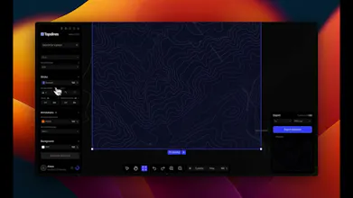
Draw a zone, generate crisp topographic contour lines, and export print-ready SVG & HD PNG. Gradients, elevation taper and Figma-ready output.
144 followers
144 followers


It would be great if you could add an option to import an existing SVG or image so we can trace over real terrain data instead of having to draw zones from scratch every time.
Topolines
@ferdivppa You draw a zone, but only to select the area. The contours come from real elevation data for that spot (SRTM 30m free, 10m GeoTIFF on paid), so there's nothing to trace over, what you get is already real terrain.
the gradient control on the elevation taper is genuinely thoughtful, gives you that subtle handmade cartography feel instead of looking like a flat computer readout. love how clean the SVG export is too.
Topolines
@coztturk23123 That's exactly the feeling I was after. Old survey maps have a weight that a flat computer readout loses. For me it's the taper plus the elevation gradient working together that gets you there, one thins the lines with height, the other shifts the colour. Thanks for noticing.
Love that the elevation taper actually shows up in the exported SVG, makes the contour map feel tactile rather than just flat geometry.
Topolines
@hacerisdf Yep, it's computed server side before export, so the editor preview and the SVG are the same thing. No baked raster.
Dial
@Alexis that's a genuinely useful caveat most "10m DEM" products don't bother explaining - the grid resolution vs actual survey fidelity distinction matters a lot for anyone picking a spot outside the US/Europe expecting the same crispness. would be a nice touch if the tool flagged which source tier a given region falls back to before someone pays for a poster of it, so they know what they're actually getting up front instead of finding out after printing.
Topolines
Seeing a few comments about drawing or sketching zones, so a quick clarification for anyone landing here: there's no freehand drawing in TopoLines. You pick a real location on a map and the contours are generated from actual elevation data (SRTM 30m, or 10m GeoTIFF on paid). The terrain you export is a real place, not a shape you drew. Happy to answer anything else.
Drew a quick mountain zone and the contour lines came out super clean, way better than the wobbly results I usually get from free tools. The HD PNG export was ready to drop straight into a print layout with no extra cleanup.
the elevation taper control is such a thoughtful touch, a lot of these tools just dump raw contour data and leave you to clean it up. the print-ready svg export is exactly what i'd want too