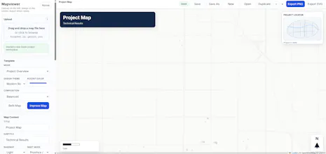
Exploration Maps helps mining and exploration teams turn shapefiles, claims, targets, and drill data into clean maps for presentations, news releases, websites, and investor materials.
No reviews yetBe the first to leave a review for Exploration Maps
Maker
📌
I built Exploration Maps after constantly running into the same problem at work: teams needed maps fast, but getting polished maps out of traditional GIS workflows was often too slow for marketing, IR, and presentation deadlines.
This is a simple map maker built for speed, not a replacement for full technical GIS work. The goal is to make it easy to upload claims and project data, add titles, labels, callouts, logos, and export something that is actually ready to use in a deck, release, or website.
It is especially useful for mining and exploration groups that need maps showing claims, targets, drillholes, peer locations, infrastructure, and regional context, without spending hours cleaning things up manually.
Still improving it, so I’m especially interested in feedback on:
- missing features
- what makes a map feel “client-ready”
- what would make this more useful for geologists, IR teams, and corporate presentations