
Wander
Location-based social app
13 followers
Location-based social app
13 followers
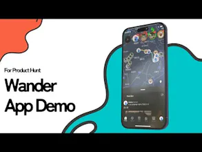
A map-based social app to post photos, videos, audio, text, and GPS tracks—right from where you are. Organize your memories on a private or shared map, and revisit them anytime in the archive.


👋 Hi everyone! I’m Arata, a solo developer from Japan 🇯🇵
I built Wander as a map-based social app where you can log your everyday moments—whether it’s a quiet walk, a trip abroad, or just something you want to remember—with photos, videos, audio, or GPS tracks.
You can post publicly or privately, and everything stays neatly archived on your own map. You can even backdate posts to reflect moments from the past, not just the present.
It’s also designed for people who don’t always want to post on Instagram but still want to save the moment.
The app now supports five languages: English, Japanese, Spanish, Simplified Chinese, and Korean 🌍
🧪 There’s also an experimental Android build available here:
https://cdn.wndr.it.com/apk/Wander_v1_2_1.apk
If you try it out, I’d love your feedback! 💬
I’m also open to feature suggestions or ideas for synergy—if there’s something you wish the app could do, let me know! 💡
Thanks for checking it out 🙌
Hey @moomoo_holstein, this looks like a great app to log your memories but also to help people explore new areas. I think this app could make traveling to new areas a lot of fun. Here are some ideas I thought of that could be added to "gamify" exploring an area:
See (some) photos only if you're in that area (location unlocks the ability to view; set by the photo owner)
Ability to set other people's photos as a 'destination' so you can travel to the same area(s) and take similar photos
Compare your travel path with other people that were in the same area
Generate a 'photo travel path' based on photos you've liked from the area to visit where the photos were taken
Mark unexplored areas based on the lowest amount of photos taken/paths traveled
This app has a lot of potential! Congrats on the launch. 🚀
@smjburton
Hi Scott, thank you for taking the time to share these ideas! 🙏
I agree completely—adding a touch of gamification to exploration feels like a perfect synergy with Wander. Your suggestions have already sparked my imagination, and I’ll start prototyping as early as tomorrow. 🚀
Visualizing unexplored versus explored areas will be the very first feature I tackle. The key question is how wide to set each boundary—should a “cleared area” be defined by city, region, or even an entire country? I’ll experiment to see which level gives the most satisfying sense of completion.
Thank you again for such thought-provoking input. If you’re curious about how these features evolve, I’d love for you to keep an eye on future updates! 🌱✨
I think this will take some experimentation to get right, but my intuition tells me it should be regions (districts) within each city as well as regions outside the city (parks, points of interest, etc). A benchmark for exploring an entire country may have to come later as adoption grows.
Definitely excited to see where this goes, and will keep an eye on future updates. Good luck! 😊
Stepfun Diligence Check
Love the idea! Great job!
📍🗺️ Wander adds a social twist to your location—exploring places just got a lot more fun 🌍🎉