Launching today

Terramapr
Draw on satellite maps and measure land to the foot
2 followers
Draw on satellite maps and measure land to the foot
2 followers
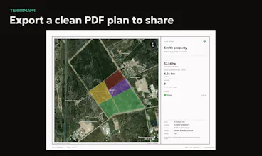
Terramapr lets you draw on satellite imagery and see exact measurements as you go: areas in acres or hectares, lengths in feet or metres. It’s built for fencing contractors, farmers, landscapers and property owners planning real work. Put a rate on any shape and Terramapr totals the quote, then send it to your client to accept online. Export a clean PDF plan. Free to start, no card needed.




Free
Launch Team

Render: Get up to $100K in startup creditsCloud infrastructure for founders who want to move fast and NOT break things
Promoted
