Maptrails

Maptrails

Plan and record your trails

3 followers

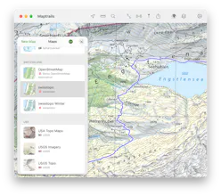
Maptrails is a feature packed map app that comes with a free collection of topographic maps. Map out your trails and record them to GPX files. Annotate maps using drawings and photos. Add your own custom maps and bring in any GeoJSON and Shapefile content.
Maptrails gallery image
Free Options
Launch tags:MapsOutdoorsHiking
Launch Team
Framer
Framer
Launch websites with enterprise needs at startup speeds.
Promoted

What do you think? …

Pasi Salenius
Maker
📌
Maptrails is an app I began developing during COVID as I wanted a better experience for browsing topographic tile maps on my iPhone. The app was designed to be easily extensible with maps from any API service, to make use of public freely available tile map services available in many countries. These custom base maps can be enriched with various kinds of layers, like Apple Pencil annotations, GeoJSON or Shapefile features or even PNG images. I really believe this is one of the most powerful and flexible map apps out there. Over the years, the app has gained many features like GPX track recording, sharing location with other users within a group and syncing data with Mac and Apple Watch apps. The app is very popular in Finland and is widely known as one of the top hiking apps here. I'm looking to gain more users abroad and make the app even better suited to more use cases.