🌐 Want to keep your memories organized by location? 📸 Looking for a GPS camera app that auto-adds location, date, and time stamps to your photos? GeoCam: GPS Photo Location is here to make your photos more informative and meaningful!
No reviews yetBe the first to leave a review for GeoCam: GPS Photo Location
Maker
📌
The Story Behind GeoCam: GPS Photo Location
I created GeoCam: GPS Photo Location out of a small, frustrating gap I noticed—both in everyday life and in professional settings. People were capturing important photos but losing the critical context behind them: where and when they were taken.
Whether it's a traveler trying to remember a hidden gem they found abroad, a field agent needing geo-verified proof of site visits, or a content creator who wants to organize their visual journey by location—this kind of functionality is incredibly useful. Yet, most built-in camera apps bury GPS info in metadata (if at all), which often gets stripped when shared. And timestamp overlays? Rarely elegant or customizable.
I wanted to change that.
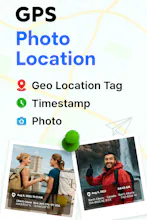
GeoCam was built as a simple but powerful GPS camera tool that stamps location, date, and time directly onto photos. No digging into metadata. No second-guessing. Just open the app, take a photo, and the essential context is captured in the frame itself.
What started as a utility for friends working in logistics and construction has now grown into a broader solution for travelers, professionals, and anyone who values organized, meaningful photo memories. The app lets users:
Instantly embed location coordinates, address, and timestamp on every photo
Customize the look and feel of the stamp (professional or minimal)
View photos on a map interface for a bird's eye view of where they've been
It’s currently live on the Play Store and slowly gaining traction organically. I’m continuing to improve the UX, add features like weather stamps and auto-backup, and listen closely to user feedback.
For me, GeoCam is more than an app—it's a tool to make your moments more traceable, reliable, and memorable.
Check it out here: 👉 GeoCam: GPS Photo Location
I love the idea! Great UX from what I’ve seen so far. Do you plan to add features like offline mode or cloud sync in future updates?
Report
Maker
@angelinashv Thank you so much! Really glad you’re enjoying the UX — that was a big focus for us from day one 🙌
Yes, both offline mode and cloud sync are on our roadmap!
Offline mode is especially important for travelers or field workers who may not always have reliable internet. We’re working on ensuring GPS data and photo stamping still work seamlessly even when offline.
Cloud sync is planned as an optional feature, allowing users to back up their geo-tagged photos and access them across devices — possibly with integrations like Google Drive or Dropbox in the future.
Appreciate your feedback — it helps shape what comes next! 😊 Stay tuned for upcoming updates!
DataTable.dev
I love the idea! Great UX from what I’ve seen so far. Do you plan to add features like offline mode or cloud sync in future updates?
@angelinashv Thank you so much! Really glad you’re enjoying the UX — that was a big focus for us from day one 🙌
Yes, both offline mode and cloud sync are on our roadmap!
Offline mode is especially important for travelers or field workers who may not always have reliable internet. We’re working on ensuring GPS data and photo stamping still work seamlessly even when offline.
Cloud sync is planned as an optional feature, allowing users to back up their geo-tagged photos and access them across devices — possibly with integrations like Google Drive or Dropbox in the future.
Appreciate your feedback — it helps shape what comes next! 😊 Stay tuned for upcoming updates!