
FlySafe.zone
The missing data layer between NOTAMs and takeoff.
2 followers
The missing data layer between NOTAMs and takeoff.
2 followers
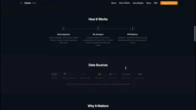
We process public aviation data — NOTAMs, conflict databases, satellite imagery — through ML models to generate airspace risk indices. 25 flight regions monitored. Updated every 5 min. API for airlines, aggregators, and travel platforms. Try the route checker demo.


Hey Product Hunt!
I built FlySafe after the February 2026 Middle East airspace shutdowns — 12 FIRs closed simultaneously, thousands of flights rerouted or cancelled.
The problem: airlines and travel platforms monitor prices, schedules, weather — but airspace risk is still a blind spot. When airspace closes, everyone reacts. Nobody had the data to plan ahead.
What FlySafe does: we process public data — NOTAMs, conflict databases, satellite imagery, ADS-B traffic — through ML models. The output is simple: send a route, get a numerical index (0-100). Updated every 5 minutes. That's it. What you build with it — a badge, a filter, a notification, an internal dashboard — is your call. We provide data, not advice.
We're B2B: flight aggregators, corporate travel platforms, airlines, insurance. If you're building in travel or aviation, I'd love to hear how you'd use route-level airspace indices. No classified data. No insider sources. Just public data + math.
Questions welcome — happy to discuss the aviation data landscape.