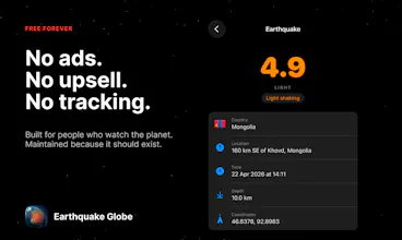
Earthquake Globe pulls live USGS data and plots every M3.0+ event on an interactive 3D globe — refreshed every 60 seconds. Pins are color-coded by magnitude and sized logarithmically so big events jump out. Set a radius (50–1,000 km from your location) and threshold to get a push notification when something happens nearby. Tectonic plate overlays and shake radius circles show geological context. Tap any pin for depth, significance, and USGS link. No account, subscription, or ads. Ever.
Hey Product Hunt, the Supafast team here.
Earthquake shows every tremor on Earth as it happens, on a globe you can spin, with the magnitude radiating out in real time. We built it because we wanted a visceral way to feel how alive the planet is, not a list of numbers in a table.
Data comes straight from USGS, the United States Geological Survey, which publishes a public feed of every detected event worldwide. The app pulls the feed every few minutes, plots each quake on a 3D globe, and animates the shockwave based on magnitude. You can rewind the past day, week, or month and watch the planet shake.
Background refresh keeps the data current even when the app is closed. If something significant happens near you (above magnitude four within five hundred kilometers), you get a notification with depth, distance, and a quick view of the rupture pattern.
There is no signup, no account, no tracking. The whole thing runs locally with SwiftData, fetching only the public USGS feed.
Tsunami advisory layers and a notification rule editor are up next. You will be able to set custom thresholds per region.
If you live somewhere seismic, what is one piece of information you wish you had earlier when something hit?
Report
No reviews yetBe the first to leave a review for Earthquake Globe