Spatialbound is Figma for the physical world, it turns any location into interactive 3D canvas. It is the world's first conversational and Spatial AI platform that unifies GIS, mapping, 4D simulation, design, and real-time events in one intelligent workflow.
No reviews yetBe the first to leave a review for Spatialbound
Maker
📌
After years in academia and research, I'm walking away from my permanent position to build a novel AI system that interact with the physical world.
The future of AI isn't just chatting; it's spatial reasoning and 4D simulation of our physical world to enable the embodiment of AI at scale. That's why today I'm launching Spatialbound: a conversational AI with native spatial reasoning and 4D simulation capabilities built into its core that thinks in 4 dimensions of space and time like humans do and builds a digital twin of the world.
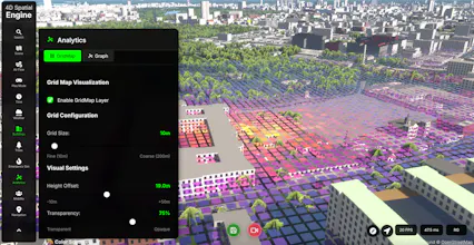
Spatialbound platform unifies all spatial workflows:
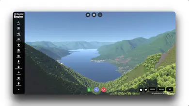
· Generate detailed maps of any location on Earth
· Analyse disaster zones in near real-time
· Find your perfect home by simulating neighbourhoods
· Navigate complex environments like a local expert
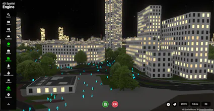
· Immerse yourself in photorealistic city simulations
· Architectural design in real-world cities
· And more…
If your job requires acting on live events and understanding global-scale data, Spatialbound Live combines everything by ingesting worldwide data and placing it in an interactive 3D globe. Instead of juggling ArcGIS for specialized maps, Google Maps for navigation, video analytics for geolocated footage, and separate 3D systems for design, we unite them all in one interface.
For gamers: Imagine playing GTA in actual real cities, exploring photorealistic streets and neighbourhoods, or playing SimCity but building your own version of the physical world with actual geographical coordinates.
For emergency responders and councils: Use Spatialbound for emergency training, infrastructure testing, and disaster preparedness. Practice scenarios, test changes, and plan responses using photorealistic simulations of your actual areas.
For architects and urban designers: Skip the tedious 3D modelling of your site, topography mapping, material libraries, and renderer hunting. Design directly in real cities and test your concepts live in photorealistic environments with Spatialbound.
People often ask me how Spatialbound's Engine compares to models like Genie 3 by Google DeepMind or single-image-to-360 generation tools (3D immersive world models). The difference? Spatialbound doesn't sacrifice physical world fidelity and global coordinate system. While others create visually impressive but abstract "candy-eye" outputs, Spatialbound maintains real-world coordinates and physical attributes. You can drive or fly a drone from London to Paris in our 4D engine, with accurate roads, terrain, and turns.
Report
@spatialbound Congratulations on the launch! Love the visuals and the overall look of the platform.
Report
Maker
@mihaela_croitor Thanks Mihaela, feel free to try it for free and let me know what you think.





@spatialbound Congratulations on the launch! Love the visuals and the overall look of the platform.
@mihaela_croitor Thanks Mihaela, feel free to try it for free and let me know what you think.