

Postcodeheatmap
Turn your spreadsheets into beautiful map visualizations
14 followers
Turn your spreadsheets into beautiful map visualizations
14 followers
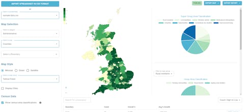
A super simple tool to visualise your customer density across UK geographic boundaries such as counties and regions. Just upload a spreadsheet of postal codes and then export your heat maps as images or generate reports.


Free Options
Launch Team

Wispr Flow: Dictation That Works Everywhere — Stop typing. Start speaking. 4x faster.
Stop typing. Start speaking. 4x faster.
Promoted
Be the first to comment