Navisens™ motionDNA™ technology locates personnel & mobile devices indoors, outdoors, & underground with zero infrastructure. No WiFi. No GPS. No maps.
@truvoip hi Alok, it looks like the website you posted basically works out proximity by learning "fingerprints" of nearby devices. Navisens instead is designed to provide an actual location similar to GPS (latitude, longitude) once we have an initial position. If all you require is knowing that you are "home" vs. "work" then that platform may be a better fit since it would be quite simple.
Report
@ashod1 Actually.. Navisens is a perfect solution if we can use it for room detection. So, turn on the living room lights when you get there and so on. I hope it can be easily integrated with Home Assistant (which is what I am using)
Also, how is the battery performance?
@truvoip ok great, please do try it out and don't hesitate to reach out to us directly if you need any assistance. The battery performance will be much lower than continually using GPS. In the lowest power mode, we will consume approx. 4% per hour (depending on phone) and as low as 1-2% per hour depending on configuration and motions performed.
Keep in mind we provide not only a position (in 3D) but also the orientation of the device (as a quaternion and Euler angles) and other contextual info such as the type of motion a user is performing (user is walking, user is fidgeting, or phone is stationary/placed on a fixed surface). Our position updates can be configured from 6-25Hz and orientation updates up to 100Hz (for AR) so tweaking each of these settings is a balance between power consumption and update rate.
Navisens is a new mobile SDK that does indoor and outdoor location much better (more accurately) than existing solutions. If you have a mobile app that relies on location to provide features/services to your users, you'll want to check out Navisens SDK ASAP.
@hnshah thanks for the hunt! I’m excited to share the unique Navisens location platform! The first thing you’ll notice: you can visit our website and instantly try a demo in your browser. No need to download an app or install any hardware or collect data! (browser demo currently iOS only)
With most location platforms you usually need to install a lot of hardware (WiFi APs or beacons) and walk around collecting signal fingerprints. Navisens is designed to avoid this as much as possible. I originally started Navisens to track firefighters. Learn more here: https://medium.com/@navisens
As smartphones have continued to advance, location systems haven’t progressed. GPS wasn’t designed with today’s use cases indoors and outdoors in dense city blocks. Cell towers, beacons and WiFi APs weren’t designed for location in the first place and either aren’t accurate and/or require a lot of infrastructure to be installed.
Navisens MotionDNA uses the accelerometers and gyroscopes inside your mobile device. All you have to do is integrate our SDK into your iOS or Android app. Navisens Cloud (seen in the web demo) is coming soon as a web API, which means you can provide navigation right inside the browser.
Try our web demo and our demo native apps and let me know what you think! If you’re ready to integrate our SDK into your app, check out our tutorial “The Beer Test” designed to get you up and running over a beer or two https://github.com/navisens/Navi...
Looking forward to everyone's feedback!
Ashod.
@ashod1 so adding this SDK will allow me to create location based data without GPS, WIFI, or external references? Cool! How accurate is it, and does it maintain its accuracy over time?
@liquidchickenqq yes that's correct! Keep in mind we require a reference point to start off with.
If you look at the animated gifs we included in this post, image 3 shows one example of setting a manual start point via a UI by asking the user to drop a pin on a map. There are several other options to do this which you can either build yourself or use our SDK plugins. Our plugins currently support using a beacon as a start point, using a POI (Point of Interest) as a start point, and soon will also include using a QR as a start point. Our SDK just requires the start coordinates, so you can really build any method or UI design to do this, we provide the plugins to help you but they're not mandatory to use. If no start coordinates are set, we simply start at (0,0) in a local coordinate frame.
Image 4 shows another example where we automatically set a start point (via the system location or GPS). This method works really well, however it requires the user to first start outdoors.
Our goal is always to be more accurate than GPS, both indoors and outdoors, and more accurate than infrastructure based systems like beacons or WiFi APs. Our performance is primarily based on the distance you have traveled rather than time, and is generally around 5% of the distance you have traveled. If you use the method in image (4) by letting Navisens manage setting the start position for you automatically, we will also periodically perform continual location updates to make sure that the accuracy is always as low as possible.
Huge potential for this product, definitely see both the consumer and enterprise use case. @ashod what are some use cases you are excited to see people build?
@ashod@liveink thanks for the nice comments Kevin! Great question! We actually started off with enterprise customers, and they've built products which help users navigate inside shopping malls, track workforces in large corporate campuses, and navigate workers in Augmented Reality with smartglasses inside power plants to make workers safer and more efficient.
We're now opening up the SDK to everyone because we're excited to see all the cool products ppl build! We've already had developers working on multi-user gaming in AR and building a navigation app for helping ppl with visual disabilities navigate indoors and outdoors!
Report
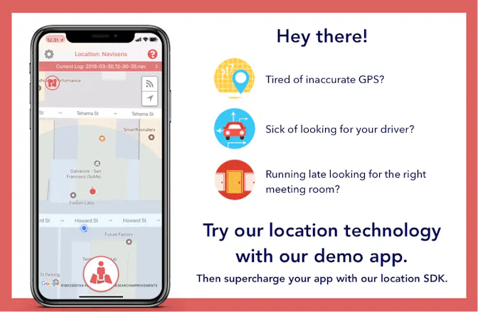
I don't have a mobile app that relies on location, but I do *use* several all the time (Uber, Lyft, Scoot,) and in San Francisco downtown, GPS frequently places me nowhere near my location. Is there a way to take advantage of Navisens as a consumer?
@brianrue great question Brian! Navisens is a location platform designed for developers to integrate into their apps, so we currently don't have any consumer-facing apps (though we do have some experiments in progress).
One of the most common suggestions we get is that Uber and Lyft should use our location technology! We agree - it's often a frustrating experience having issues with GPS especially downtown. We'd be happy to work with Uber and Lyft! If you'd like to give them a nudge, feel free to quote reply our Tweet and tag them! 😁 thanks! https://twitter.com/navisens/sta...
Hope this gets built into any app that uses location. I'm looking forward to never have to ask "which aisle is the soap etc. in?" ever again, or never getting lost at the mall, so many interesting use cases here!
@olofster thanks for the comments Olof! We're excited to start having a wider range of apps integrating our SDK, and we also have a few app experiments we're working on ourselves! (stay tuned for a future post!)
Report
Congrats Ashod!
Quick question, we have only a few beacons in a building but it’s not enough for navigating users. Can Navisens integrate with our existing beacons?
@therealpepeg thanks Geoff! Great question, we sure can integrate with beacons! A recurring issue we see from some of our customers is that they have installed beacons, but not enough to cover the entire floorplan and certainly not enough for navigation (more for just proximity).
We actually created a plugin for our SDK called NaviBeacon which helps our customers integrate beacons with Navisens very easily. All you need to do is specify the ID and the location of each beacon, and the NaviBeacon plugin will do the rest!
Here are the details:
- iOS: https://github.com/navisens/iOS-...
- Android: https://github.com/navisens/Andr...
Hi Ashod,
Great work! I have been using Navisens’ MotionDNA demo app on my Google Pixel 2 and the results look pretty good.
I did a few loops of a rectangular trajectory and while the trail generated by your algorithm scales pretty well with the actual dimension of the path, I experienced a constant drift which made the actual rectangular trail appear like a rotated rhombus. Could this be an IMU calibration issue or is your algorithm sensor agnostic?
Looking forward to your feedback.
@khan08 hi Saad, thanks for the nice comments and feedback! Glad to hear that the trail scaled well. Regarding the drift, was that our web demo or our native app? If our native app, could you upload the dataset to us using the upload feature in our demo app? We'll then analyze it and give you an update. If you could email support @navisens.com after you've uploaded the dataset that would be great. Thanks for your support!
Navisens
Navisens
Crazy Egg
Navisens
Social Friendzy
Navisens
Farmstead
Navisens
Navisens
Mixmax
Navisens
Navisens
Navisens